Earlier, the AEC sector relied on 2D graphics to convey design and building data. However, the construction industry has advanced significantly in the era of digitalization with the introduction of Point Cloud technology and the conversion of Point Cloud to 3D Models such as BIM.
Point Cloud to BIM is proven effective and quick for using 3D models to portray an accurate digital representation after laser scanning a space or geography.
Our BIM specialists turn millions of points of data or photos from laser scanning into intricate 3D BIM Models for the MEP, architectural, and structural elements of historic structures.
Our Point Cloud Modeling Services enable the conversion of 3D scan data into BIM Modeling services for the documenting of as-built design data and hasten quantity extraction through the adoption of BIM inside businesses.
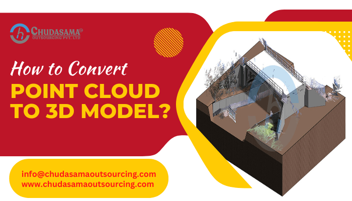
Point Cloud to BIM, also known as Scan to BIM, is the method of collecting point clouds of a place, building, or surroundings and displaying them to produce a 3D BIM model. After being created, the point cloud data is a simple illustration of the information or target points from laser scanners.
A mesh must be created from the point cloud in order to generate an accurate and data-rich 3D model. A 3D solid modeling application is used to construct the Point Cloud meshes in the intricate BIM models that show how the parts fit together in the construction method.
Point Cloud to 3D Model can be used for many different building project processes, including construction site validation, planning for designing, verification of design, design assessment, Renovation, quantity takeoffs, MEP cooperation, As-built drawings, cost estimates, etc.
Process of Converting Point Cloud to BIM
-
Capture:
Gather all project-related data, and specify the project’s work scope, LOD, BIM execution strategy, and due date. Before gathering the site’s data points, this step focuses on the client’s anticipations, an assessment of the scanning equipment in relation to the scanner’s capability, and lastly the site’s state.
-
Procedure:
The data about the facility’s or site’s as-built conditions must be scanned as soon as it has been verified and gathered. It is necessary to align the scanned data using a variety of techniques, including best fit, orthogonal, georeferencing, etc.
-
Modeling:
This step decides how the point cloud will be digitally represented as a 3D BIM Model. Check out the steps that are described here:
-
Validation:
The project’s LOA (Level of Accuracy), LOD (Level of Detail), and task scope must all be discussed in clear terms. A BIM implementation strategy can be successfully implemented when the tolerance grade of variation is explicit and well-defined. The point cloud’s coordinates and details need to be verified using programs.
-
Insertion:
The files are loaded into Revit BIM and pinned down using a PIN tool after the Point cloud has been verified.
-
Setup:
The job that must be completed in order to begin the 3D BIM file setup procedure should dictate the creation of work sets. For each Point Cloud, it is recommended to use several works sets so that the setting can be adjusted and turned on or off as needed. This will shorten the file’s available time. To configure the stages from a Plan View, be sure to lock it.
-
Modeling:
Each component needs to be accurately described and modeled as an individual. Instead of using a general model with a number of extrusions, Revit Elements must be used. All the elements should always be presented on the appropriate levels.
By slicing tiny view angles in section and plan views, the borders of the model should be fitted to the Point Cloud as closely as possible. Always choose Interior/Exterior Finish as the wall restrict option when designing a perimeter wall in a plan view.
-
Collaboration:
The secret to 3D Modeling success is efficient stakeholder communication. The same Point cloud storage path, appropriate application, version, and upgrades should be used by all parties. Establishing shared coordinates, levels, and grids with a control model will prevent any parties from being able to change, move, or remove the data.
-
Quality Inspection:
Pursue a comprehensive quality inspection procedure to guarantee the model’s quality. It is advised to use a 3D view, plan, or section to carefully compare a defined region. Detecting clashes for MEP cooperation. It is crucial to tidy up the file and remove all the model’s connection points and fine-grained lines.
Advantages of Point Cloud to BIM Services
-
Accuracy:
Outputs that are more precise and timely for creating 3D representations of a space or landscape. The point cloud is accurate to a precision of 1 to 30 centimeters, and field-based LIDAR will produce findings that are precise to a millimeter level.
LIDAR typically combines additional features, such as GPS, to ensure that each data and information point has accurate data.
-
Efficiency:
When you upload your point cloud to a photorealistic rendering platform, you may arrange the data without having to manually triangulate each point.
You don’t have to spend the hours you might have otherwise had to spend manipulating information since the program performs it for you. With these hours cut down, you may gather the project’s specifics more quickly and go to work sooner, which will result in a quicker completion date.
-
Cost-Efficient:
You may create a more effective expenditure plan for your operations due to the greater accuracy involved in project planning using point clouds. If you can avoid going over your budget, there will be less chance of costly hiccups or unexpected expenses.
-
Safety will Increase:
Manually surveying can include navigating challenging terrain, posing a safety risk to surveyors. Drones are included in the point cloud for safe data collection from these dangerous terrains.
Conclusion
Point clouds are increasingly being applied to BIM Services to increase efficiency and clear interaction in BIM architecture. The strength of cloud computing enables 3D BIM Models and point cloud certifications that are quicker, more precise, trustworthy, and less costly.
Outsourcing BIM Services results in the creation of a data environment where construction renovation providers may gather, access, and share project information.